July 24th Svolvær - Skutvik
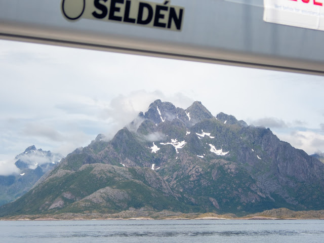
When you name your boat after a mountain that is more that is more than 1400 km by road and 900 nm by boat from your home getting the boat in position to take a photo with both the boat and the mountain in the same frame is a major goal.
At 1062 very steep meters Rulten is regarded as around the 6th most difficult mountains to climb in Norway (the easiest route). So getting to the top isn't an option for an owerveight vertigo plagued sailor, my plan was instead to anchor in a bay somewhere in the vicinity to get nice shots from the dinghy or kayak with the boat and the mountain, but the chart plotter debacle prevented that this year.
As with many of the difficult or impressive mountains in Norway the first to climb Rulten was William Cecil Slingsby in 1903. Based on the number of articles and the pictures in them on climbing forums on internet climbing Rulten seems to be a real treat for individuals inclined for the crazy sport of mountaineering.
To be honest I didn't even know that Rulten was a mountain when I named the boat. I took the name from a steam purse seiner owned by my great great grandfather and his sons fishery company owned between 1907 and 1934. The name was chosen because my grandfathers purse seiner was named Gjøa and I felt that I might be viewed as presumption with a boat with that name. Not because of my grandfathers boat, but a more famous Norwegian got another ship with the same name the same year (1907) and this Gjøa is one of the most merited expedition ship in history.
I probably should explain the chart plotter debacle. This morning, when I was ready to sail off, after have briefly met sa friend that was on a cruise with tall ship Christian Radich, I couldn't get the chart plotter to read the map chip. I have had this problem before last at Nyvågar, but I have always been able to fiddle with the thing and get it to work. But this morning nothing helped. I tried borrowing a chip from another boat, he tried my chip in his plotter but nothing worked. Then i walked over to the Navico dealer in Svolvær, Hibotech. One of the technicians there came back and checked. In the end it turned out that it wouldn't be feasible to try to repair the chart plotter. Regrettably they didn't have a suitable Navico plotter in stock and the Raymarine the had wouldn't work with the WiFi thing on my boat. This being on a friday and I needing to turn back south soon instead of them ordering a new plotter they helped me contacting their competitor in Bodø so that I could have them order a new plotter for me, since they didn't have anything suitable in stock either. However ETA for the Simrad plotter that best suited my need would be around Wednesday the 29th. (three working days). Ideally a B&G plotter would have been even better, but I didn't use the sailing specific function on my old plotter, that the Simrad would lack so no loss.
After the photo session of Rulten I really turned the bow southwards and crossed over Vestfjorden to Skutvik. The actual northernmost point of the cruise was just off the dock inside the harbour of Svolvær at 68º14'N.


No comments:
Post a Comment